
Automated Network Design & Simulation Software
Network design software for district heating and cooling
Draw a district once and let our software do the rest. The least-cost pipe route, every diameter, every pressure loss and the trench cost that follows are recalculated the moment your layout changes.
100% Tailored
- Dedicated onboarding
- Custom data integration
- Dedicated support
 Swiss Made













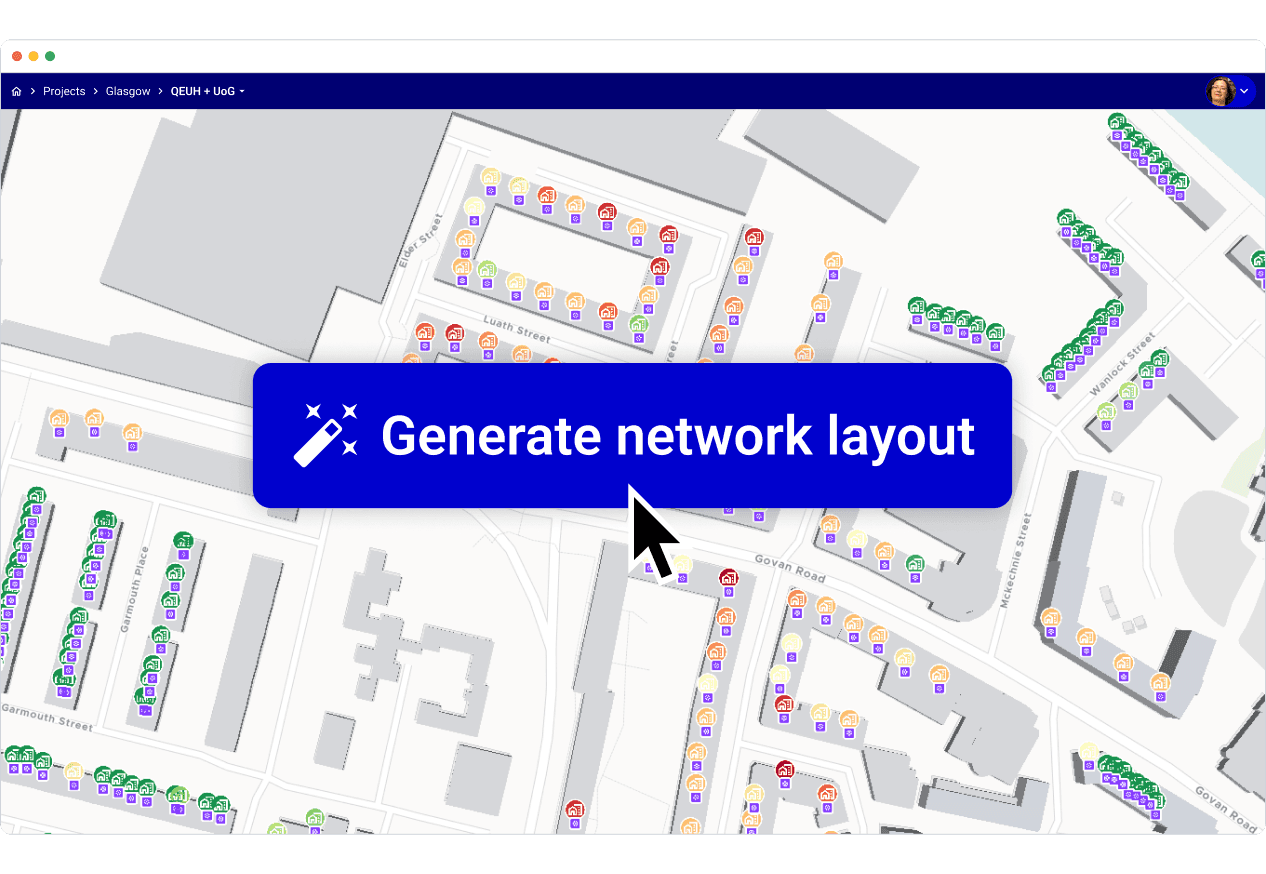
Generate the network layout in one click
Select your buildings and routing data and it returns a layout that minimises trench length and thermal losses at once. Every street is evaluated, not just the obvious ones, and the result is a starting point you can argue with, not a black box.
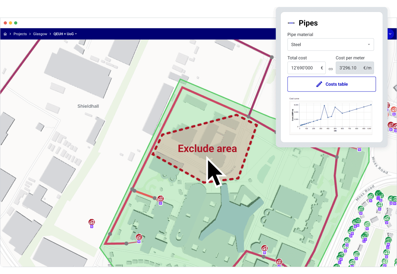
Keep engineering judgement in the loop
Edit the route directly on the map: exclude a street, protect a park, force a crossing, add or drop connection points. Pipe families, insulation classes and cost per metre are all yours to override, so the model matches the project you can actually build.
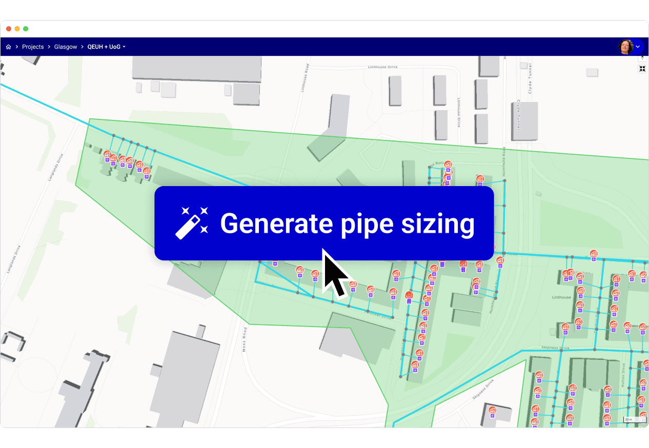
Size every pipe, not just the mains
Diameters, flow velocities, pressure losses and heat losses are computed segment by segment against your own supplier catalogues, then rolled up into a bill of materials you can send to a contractor.
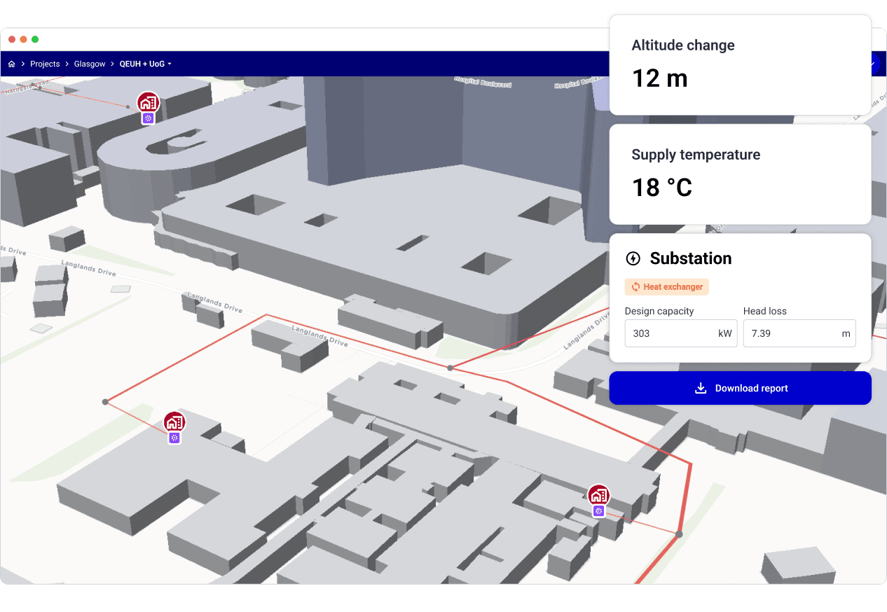
One model from feasibility to detailed design
The file that produced your feasibility variant carries straight through to detailed design, so nothing is re-entered and nothing shifts. Altitude differences, multiple injection points, substation sizing and low-temperature single pipe loops are all part of the same model.
We needed a solution that could support our design decisions and optimize projects from the ground up. We're finally able to do just that—saving time, improving accuracy, and ensuring we make the best possible impact with each project.
 Loic QuiquerezExpert Advisor in Geothermal Energy and District Heating & CoolingSIG

Frequently asked questions
How long does it take to design a network with your software?
Hours, not months. Users routinely go from an area of interest to a routed, sized network with costs in under two hours, and variants after that take minutes.
Can I import my own GIS data?
Yes. Excel, CSV, GeoJSON, JSON, GPKG and SHP files drop straight onto the map, and results export in the same formats.
Does it handle 5ᵗʰ-generation (low-energy) networks?
Yes. Uninsulated single-pipe loops, decentralised heat pumps at each substation and low-temperature vectors between 3 and 15 °C are first-class cases, not workarounds.
Get inspired by other district thermal network design projects designed on Planeto.
Grandvaux - Switzerland

Haute-Sorne - Switzerland

Schaffhausen - Switzerland
Ready to design your next thermal network?
- Get a free demo and onboarding setup
- No credit card required